
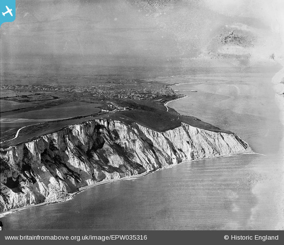
EPW035316 ENGLAND (1931). Beachy Head and the South Downs Way, Beachy Head, from the south-west, 1931
© Copyright OpenStreetMap contributors and licensed by the OpenStreetMap Foundation. 2026. Cartography is licensed as CC BY-SA.
Nearby Images (3)
EPW035316

EPW051360

EPW051361

Details
| Title | [EPW035316] Beachy Head and the South Downs Way, Beachy Head, from the south-west, 1931 |
| Reference | EPW035316 |
| Date | 25-May-1931 |
| Link | |
| Place name | BEACHY HEAD |
| Parish | |
| District | |
| Country | ENGLAND |
| Easting / Northing | 558896, 95343 |
| Longitude / Latitude | 0.25200269874706, 50.735364190894 |
| National Grid Reference | TV589953 |
Pins

Alan McFaden |
Wednesday 20th of November 2013 11:27:24 PM | |
|
Alan McFaden |
Monday 15th of July 2013 09:57:33 AM |

