
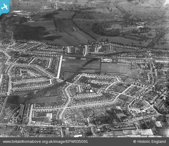
EPW035091 ENGLAND (1931). Thie District and Piccadilly Lines and surrounding residential development, Lampton, 1931
© Copyright OpenStreetMap contributors and licensed by the OpenStreetMap Foundation. 2026. Cartography is licensed as CC BY-SA.
Nearby Images (5)
EPW035091

EPW017384

EPW035075

EPW011660

EPW056166

Details
| Title | [EPW035091] Thie District and Piccadilly Lines and surrounding residential development, Lampton, 1931 |
| Reference | EPW035091 |
| Date | May-1931 |
| Link | |
| Place name | LAMPTON |
| Parish | |
| District | |
| Country | ENGLAND |
| Easting / Northing | 514470, 176770 |
| Longitude / Latitude | -0.3514705680331, 51.477805929233 |
| National Grid Reference | TQ145768 |
Pins

glennsalt@gmail.com |
Sunday 4th of September 2016 10:53:27 AM | |
|
glennsalt@gmail.com |
Sunday 4th of September 2016 10:51:39 AM |