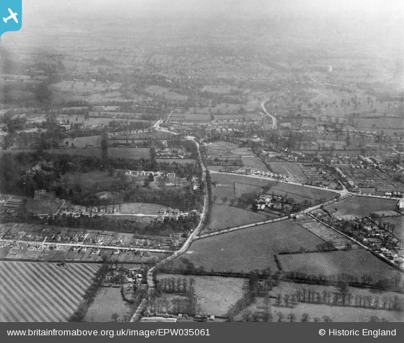
EPW035061 ENGLAND (1931). Kynaston Lodge and environs, Harrow Weald, from the south-west, 1931. This image has been produced from a copy-negative.
© Copyright OpenStreetMap contributors and licensed by the OpenStreetMap Foundation. 2026. Cartography is licensed as CC BY-SA.
Details
| Title | [EPW035061] Kynaston Lodge and environs, Harrow Weald, from the south-west, 1931. This image has been produced from a copy-negative. |
| Reference | EPW035061 |
| Date | April-1931 |
| Link | |
| Place name | HARROW WEALD |
| Parish | |
| District | |
| Country | ENGLAND |
| Easting / Northing | 514662, 191423 |
| Longitude / Latitude | -0.34393121456817, 51.609478326936 |
| National Grid Reference | TQ147914 |
Pins

Ariel |
Monday 24th of August 2020 12:40:22 AM | |

Ariel |
Monday 24th of August 2020 12:39:09 AM | |

jrb1987 |
Wednesday 8th of November 2017 04:34:03 PM | |

jrb1987 |
Wednesday 8th of November 2017 04:29:34 PM | |

jrb1987 |
Wednesday 8th of November 2017 04:19:05 PM | |

jrb1987 |
Wednesday 8th of November 2017 04:09:41 PM | |

jrb1987 |
Wednesday 8th of November 2017 03:40:52 PM |


![[EPW035061] Kynaston Lodge and environs, Harrow Weald, from the south-west, 1931. This image has been produced from a copy-negative.](http://britainfromabove.org.uk/sites/all/libraries/aerofilms-images/public/100x100/EPW/035/EPW035061.jpg)
![[EPW009571] Harrow Weald Park, Harrow Weald, from the south, 1923](http://britainfromabove.org.uk/sites/all/libraries/aerofilms-images/public/100x100/EPW/009/EPW009571.jpg)
![[EPW009573] Harrow Weald Park, Harrow Weald, from the south, 1923](http://britainfromabove.org.uk/sites/all/libraries/aerofilms-images/public/100x100/EPW/009/EPW009573.jpg)