
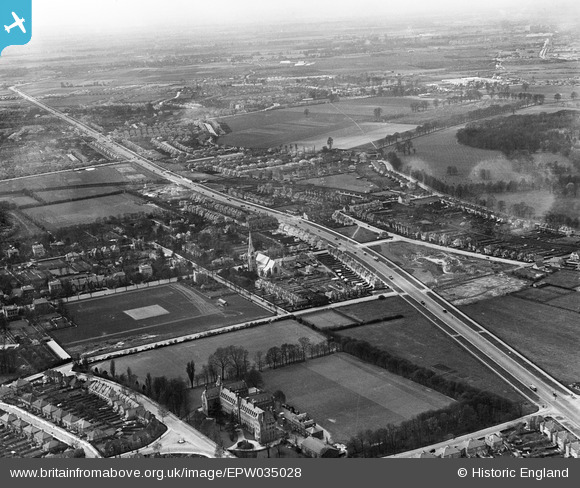
EPW035028 ENGLAND (1931). St Mary's Church and the Great West Road, Osterley, from the east, 1931
© Copyright OpenStreetMap contributors and licensed by the OpenStreetMap Foundation. 2026. Cartography is licensed as CC BY-SA.
Details
| Title | [EPW035028] St Mary's Church and the Great West Road, Osterley, from the east, 1931 |
| Reference | EPW035028 |
| Date | April-1931 |
| Link | |
| Place name | OSTERLEY |
| Parish | |
| District | |
| Country | ENGLAND |
| Easting / Northing | 515451, 177142 |
| Longitude / Latitude | -0.33722753500259, 51.480950340973 |
| National Grid Reference | TQ155771 |
Pins

longshot |
Tuesday 7th of November 2023 12:42:58 AM | |
|
longshot |
Tuesday 7th of November 2023 12:39:22 AM | |
|
longshot |
Tuesday 7th of November 2023 12:36:58 AM | |
|
CJC |
Tuesday 27th of April 2021 08:04:35 PM | |
|
CJC |
Tuesday 27th of April 2021 08:02:30 PM | |
|
slocumjoseph |
Monday 8th of February 2021 01:02:29 AM | |
|
slocumjoseph |
Monday 8th of February 2021 12:59:37 AM | |

Class31 |
Thursday 23rd of July 2015 03:57:48 PM |
