
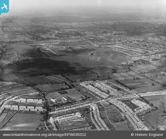
EPW035012 ENGLAND (1931). Stag Lane Aerodrome and surrounding residential development, Queensbury, from the south, 1931
© Copyright OpenStreetMap contributors and licensed by the OpenStreetMap Foundation. 2026. Cartography is licensed as CC BY-SA.
Nearby Images (2)
EPW035012

EPW035013

Details
| Title | [EPW035012] Stag Lane Aerodrome and surrounding residential development, Queensbury, from the south, 1931 |
| Reference | EPW035012 |
| Date | 18-April-1931 |
| Link | |
| Place name | QUEENSBURY |
| Parish | |
| District | |
| Country | ENGLAND |
| Easting / Northing | 519195, 189551 |
| Longitude / Latitude | -0.2791283769368, 51.591710682669 |
| National Grid Reference | TQ192896 |
Pins

Graham Honey |
Tuesday 11th of June 2024 06:08:14 PM | |
|
The Laird |
Tuesday 28th of April 2015 01:05:37 PM | |
|
simes188 |
Friday 13th of December 2013 10:50:09 PM | |

Class31 |
Saturday 30th of March 2013 08:58:43 PM | |
|
Class31 |
Saturday 30th of March 2013 08:58:00 PM | |
|
Class31 |
Saturday 30th of March 2013 08:57:19 PM | |
|
Class31 |
Saturday 30th of March 2013 08:56:13 PM | |
|
Class31 |
Saturday 30th of March 2013 08:55:51 PM | |
|
Class31 |
Saturday 30th of March 2013 08:55:32 PM |