
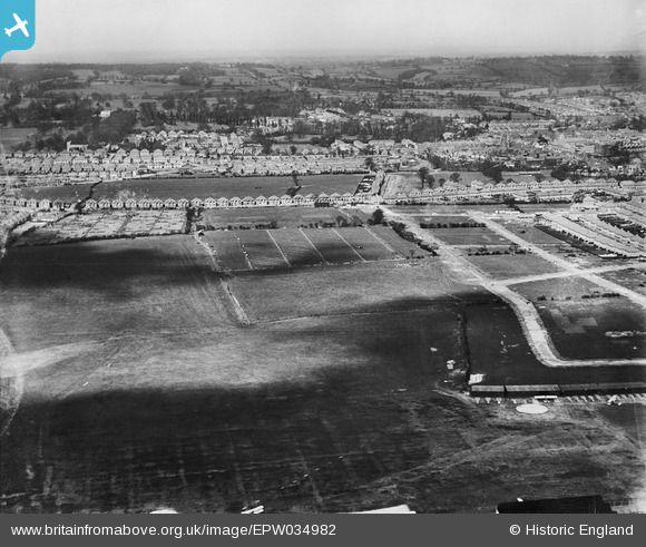
EPW034982 ENGLAND (1931). Housing development adjacent to Stag Lane Aerodrome, Little Stanmore, from the south-east, 1931
© Copyright OpenStreetMap contributors and licensed by the OpenStreetMap Foundation. 2026. Cartography is licensed as CC BY-SA.
Nearby Images (22)
EPW034982

EPW034982
EPW031582

EPW034798

EPW034981

EPW034981
EPW034979

EPW018148

EPW034977

EPW025074

EPW030058

EPW030056

EPW031546

EPW030057

EPW031547

EPW034797

EPW022364

EPW025073

EPW025691

EPW032892

EPW047557

EPW035015

Details
| Title | [EPW034982] Housing development adjacent to Stag Lane Aerodrome, Little Stanmore, from the south-east, 1931 |
| Reference | EPW034982 |
| Date | April-1931 |
| Link | |
| Place name | LITTLE STANMORE |
| Parish | |
| District | |
| Country | ENGLAND |
| Easting / Northing | 519416, 190388 |
| Longitude / Latitude | -0.27565431315956, 51.599187068682 |
| National Grid Reference | TQ194904 |
Pins
Be the first to add a comment to this image!