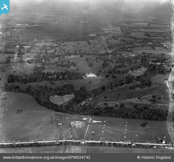
EPW034742 ENGLAND (1930). Stoke Park House, Stoke Poges Golf Course and surrounding countryside, Stoke Poges, from the south, 1930
© Copyright OpenStreetMap contributors and licensed by the OpenStreetMap Foundation. 2024. Cartography is licensed as CC BY-SA.
Details
| Title | [EPW034742] Stoke Park House, Stoke Poges Golf Course and surrounding countryside, Stoke Poges, from the south, 1930 |
| Reference | EPW034742 |
| Date | 29-October-1930 |
| Link | |
| Place name | STOKE POGES |
| Parish | STOKE POGES |
| District | |
| Country | ENGLAND |
| Easting / Northing | 496945, 182240 |
| Longitude / Latitude | -0.60226341299558, 51.530256014314 |
| National Grid Reference | SU969822 |
Pins
 dave43 |
Friday 14th of December 2012 09:59:11 PM | |
 dave43 |
Friday 14th of December 2012 09:58:12 PM | |
This is Granville Avenue. The house to the right of this flag is still there, extensions added. The stream to the left is a giveaway too. No.39 is adjacent to it, my aunt & uncle used to live there. |
 payitforwardeddie |
Monday 24th of June 2013 01:22:09 PM |


![[EPW034742] Stoke Park House, Stoke Poges Golf Course and surrounding countryside, Stoke Poges, from the south, 1930](http://britainfromabove.org.uk/sites/all/libraries/aerofilms-images/public/100x100/EPW/034/EPW034742.jpg)
![[EPW034743] Stoke Park House, Stoke Poges Golf Course and surrounding countryside, Stoke Poges, from the south, 1930](http://britainfromabove.org.uk/sites/all/libraries/aerofilms-images/public/100x100/EPW/034/EPW034743.jpg)