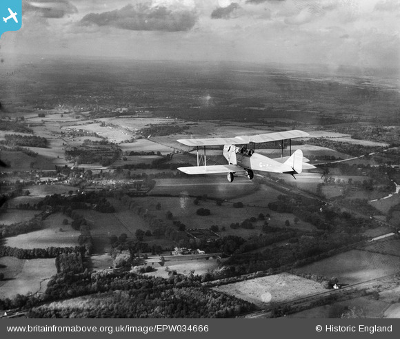
EPW034666 ENGLAND (1930). Avro 616 Sports "Avian" aircraft G-AAYU in flight, Denham, from the south-east, 1930
© Copyright OpenStreetMap contributors and licensed by the OpenStreetMap Foundation. 2026. Cartography is licensed as CC BY-SA.
Details
| Title | [EPW034666] Avro 616 Sports "Avian" aircraft G-AAYU in flight, Denham, from the south-east, 1930 |
| Reference | EPW034666 |
| Date | 16-October-1930 |
| Link | |
| Place name | DENHAM |
| Parish | DENHAM |
| District | |
| Country | ENGLAND |
| Easting / Northing | 504996, 186992 |
| Longitude / Latitude | -0.48480866714454, 51.571533074793 |
| National Grid Reference | TQ050870 |
Pins

The Laird |
Sunday 24th of February 2019 08:47:47 PM | |

moses72 |
Friday 18th of October 2013 09:54:47 AM | |

moses72 |
Friday 18th of October 2013 09:53:51 AM | |

moses72 |
Friday 30th of August 2013 07:27:28 PM | |

moses72 |
Friday 30th of August 2013 07:25:43 PM | |

moses72 |
Friday 30th of August 2013 07:24:32 PM | |

moses72 |
Friday 30th of August 2013 07:22:08 PM | |

moses72 |
Friday 30th of August 2013 07:21:07 PM | |

moses72 |
Friday 30th of August 2013 07:20:26 PM | |

moses72 |
Friday 30th of August 2013 07:19:10 PM |


![[EPW034666] Avro 616 Sports "Avian" aircraft G-AAYU in flight, Denham, from the south-east, 1930](http://britainfromabove.org.uk/sites/all/libraries/aerofilms-images/public/100x100/EPW/034/EPW034666.jpg)
![[EPW059068] Denham Court, Denham, 1938](http://britainfromabove.org.uk/sites/all/libraries/aerofilms-images/public/100x100/EPW/059/EPW059068.jpg)
![[EPW059067] Denham Court, Denham, 1938](http://britainfromabove.org.uk/sites/all/libraries/aerofilms-images/public/100x100/EPW/059/EPW059067.jpg)