
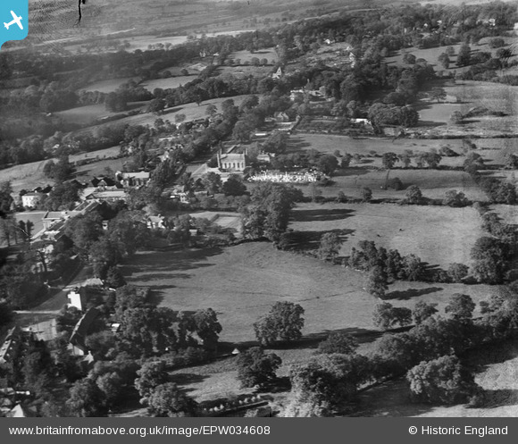
EPW034608 ENGLAND (1930). St Paul's Church and environs, Mill Hill, 1930
© Copyright OpenStreetMap contributors and licensed by the OpenStreetMap Foundation. 2026. Cartography is licensed as CC BY-SA.
Nearby Images (13)
EPW034608

EPW034607

EPW006288

EPW034605

EPW005605

EPW005604

EPW006285

EPW006287

EPW005608

EPW025805

EPW005609

EPW009650

EPW005606

Details
| Title | [EPW034608] St Paul's Church and environs, Mill Hill, 1930 |
| Reference | EPW034608 |
| Date | 16-October-1930 |
| Link | |
| Place name | MILL HILL |
| Parish | |
| District | |
| Country | ENGLAND |
| Easting / Northing | 522657, 192745 |
| Longitude / Latitude | -0.22805378882409, 51.619675282649 |
| National Grid Reference | TQ227927 |
Pins
Be the first to add a comment to this image!