
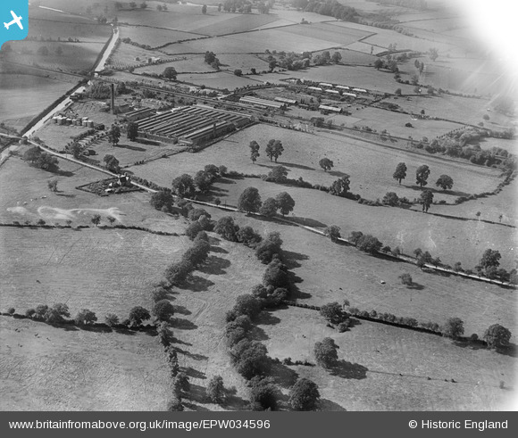
EPW034596 ENGLAND (1930). Cadbury's Blackpole Chocolate Factory and environs, Blackpole, 1930
© Copyright OpenStreetMap contributors and licensed by the OpenStreetMap Foundation. 2025. Cartography is licensed as CC BY-SA.
Nearby Images (3)
EPW034596

EPW034592

EPW034588

Details
| Title | [EPW034596] Cadbury's Blackpole Chocolate Factory and environs, Blackpole, 1930 |
| Reference | EPW034596 |
| Date | August-1930 |
| Link | |
| Place name | BLACKPOLE |
| Parish | |
| District | |
| Country | ENGLAND |
| Easting / Northing | 386871, 257939 |
| Longitude / Latitude | -2.1922021868903, 52.219105427743 |
| National Grid Reference | SO869579 |
Pins

Cowshed |
Friday 15th of November 2013 09:42:54 PM |