
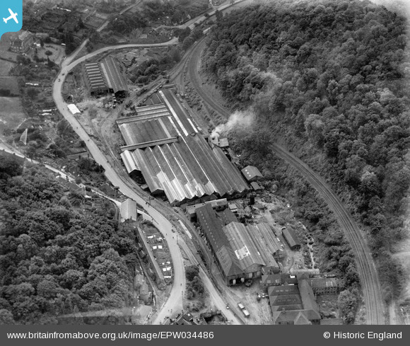
EPW034486 ENGLAND (1930). Coalbrookdale Iron Works, Coalbrookdale, 1930
© Copyright OpenStreetMap contributors and licensed by the OpenStreetMap Foundation. 2026. Cartography is licensed as CC BY-SA.
Nearby Images (2)
EPW034486

EPW034288

Details
| Title | [EPW034486] Coalbrookdale Iron Works, Coalbrookdale, 1930 |
| Reference | EPW034486 |
| Date | August-1930 |
| Link | |
| Place name | COALBROOKDALE |
| Parish | THE GORGE |
| District | |
| Country | ENGLAND |
| Easting / Northing | 366825, 304521 |
| Longitude / Latitude | -2.4902827930603, 52.637070380454 |
| National Grid Reference | SJ668045 |
Pins

severnsider |
Monday 29th of July 2013 04:17:16 PM | |
|
severnsider |
Monday 29th of July 2013 04:16:34 PM | |
|
severnsider |
Monday 29th of July 2013 04:16:13 PM | |
|
severnsider |
Monday 29th of July 2013 04:15:46 PM |