
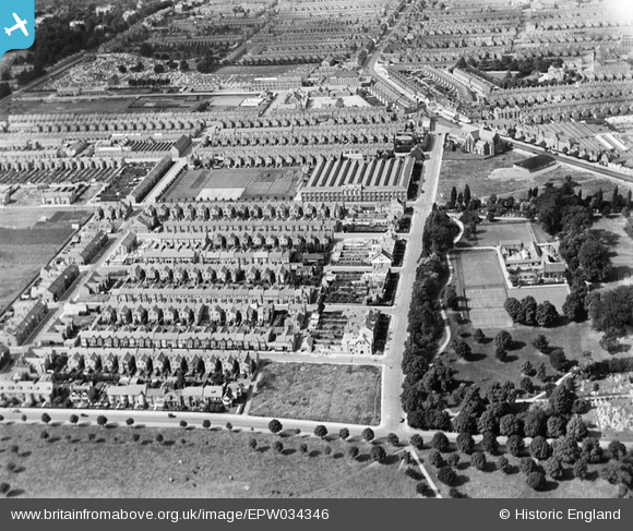
EPW034346 ENGLAND (1930). Christchurch Road and environs, Abington, 1930
© Copyright OpenStreetMap contributors and licensed by the OpenStreetMap Foundation. 2026. Cartography is licensed as CC BY-SA.
Nearby Images (3)
EPW034346

EPW057754

EPW057751

Details
| Title | [EPW034346] Christchurch Road and environs, Abington, 1930 |
| Reference | EPW034346 |
| Date | August-1930 |
| Link | |
| Place name | ABINGTON |
| Parish | |
| District | |
| Country | ENGLAND |
| Easting / Northing | 477420, 261231 |
| Longitude / Latitude | -0.86597160746533, 52.243414739747 |
| National Grid Reference | SP774612 |
Pins
Lynda Tubbs |
Wednesday 11th of September 2013 12:16:00 PM | |

Euclid |
Sunday 24th of March 2013 07:22:06 AM | |
|
Euclid |
Sunday 24th of March 2013 07:20:17 AM | |
|
Euclid |
Sunday 24th of March 2013 07:12:39 AM | |
|
Euclid |
Sunday 24th of March 2013 07:11:49 AM | |
|
Euclid |
Sunday 24th of March 2013 07:10:55 AM |