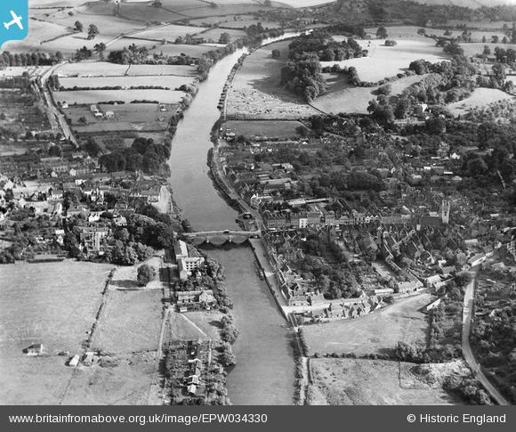
EPW034330 ENGLAND (1930). The River Severn and the town centre, Bewdley, from the north-west, 1930
© Copyright OpenStreetMap contributors and licensed by the OpenStreetMap Foundation. 2025. Cartography is licensed as CC BY-SA.
Nearby Images (6)
Details
| Title | [EPW034330] The River Severn and the town centre, Bewdley, from the north-west, 1930 |
| Reference | EPW034330 |
| Date | July-1930 |
| Link | |
| Place name | BEWDLEY |
| Parish | BEWDLEY |
| District | |
| Country | ENGLAND |
| Easting / Northing | 378624, 275514 |
| Longitude / Latitude | -2.3140484662142, 52.376866554803 |
| National Grid Reference | SO786755 |
Pins

Andre |
Wednesday 3rd of March 2021 05:25:09 AM | |

Lilia |
Sunday 28th of February 2021 08:26:04 AM | |

gBr |
Monday 7th of March 2016 08:14:29 PM | |

Class31 |
Sunday 27th of July 2014 07:36:50 AM | |

Class31 |
Sunday 27th of July 2014 12:07:56 AM | |

Class31 |
Saturday 26th of July 2014 11:59:05 PM | |

Class31 |
Saturday 26th of July 2014 11:53:22 PM |
User Comment Contributions
Bewdley Bridge, 15/08/2015 |

Class31 |
Wednesday 19th of August 2015 01:33:39 PM |


![[EPW034330] The River Severn and the town centre, Bewdley, from the north-west, 1930](http://britainfromabove.org.uk/sites/all/libraries/aerofilms-images/public/100x100/EPW/034/EPW034330.jpg)
![[EPW034333] Load Street and environs, Bewdley, 1930](http://britainfromabove.org.uk/sites/all/libraries/aerofilms-images/public/100x100/EPW/034/EPW034333.jpg)
![[EAW046200] Load Street and the town centre, Bewdley, 1952](http://britainfromabove.org.uk/sites/all/libraries/aerofilms-images/public/100x100/EAW/046/EAW046200.jpg)
![[EAW046202] The town, Bewdley, 1952](http://britainfromabove.org.uk/sites/all/libraries/aerofilms-images/public/100x100/EAW/046/EAW046202.jpg)
![[EAW046201] The town, Bewdley, 1952](http://britainfromabove.org.uk/sites/all/libraries/aerofilms-images/public/100x100/EAW/046/EAW046201.jpg)
![[EPW034443] St Anne's Church and Welch Gate, Bewdley, 1930](http://britainfromabove.org.uk/sites/all/libraries/aerofilms-images/public/100x100/EPW/034/EPW034443.jpg)