
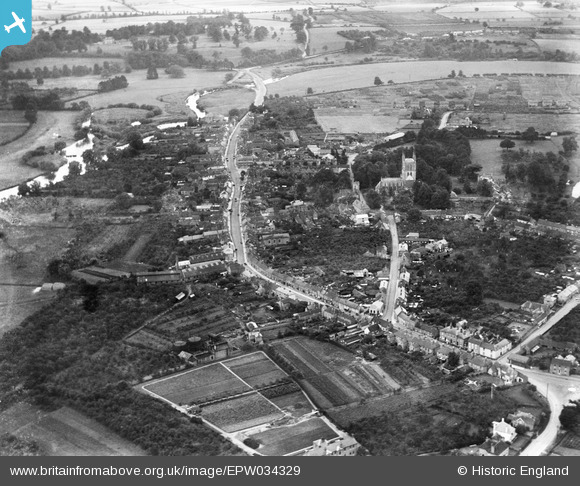
EPW034329 ENGLAND (1930). The town, Pershore, from the north, 1930
© Copyright OpenStreetMap contributors and licensed by the OpenStreetMap Foundation. 2026. Cartography is licensed as CC BY-SA.
Nearby Images (10)
EPW034329

EPW058643

EPW058638

EPW058640

EPW058641

EPW058642

EPW058639

EPW023953

EPW023952

EPW034328

Details
| Title | [EPW034329] The town, Pershore, from the north, 1930 |
| Reference | EPW034329 |
| Date | July-1930 |
| Link | |
| Place name | PERSHORE |
| Parish | PERSHORE |
| District | |
| Country | ENGLAND |
| Easting / Northing | 394747, 246200 |
| Longitude / Latitude | -2.0767198236167, 52.113685908263 |
| National Grid Reference | SO947462 |
Pins
Be the first to add a comment to this image!