
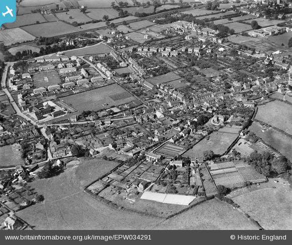
EPW034291 ENGLAND (1930). Shrewsbury Road and environs, Market Drayton, 1930
© Copyright OpenStreetMap contributors and licensed by the OpenStreetMap Foundation. 2026. Cartography is licensed as CC BY-SA.
Nearby Images (3)
EPW034291

EPW058396

EPW034292

Details
| Title | [EPW034291] Shrewsbury Road and environs, Market Drayton, 1930 |
| Reference | EPW034291 |
| Date | July-1930 |
| Link | |
| Place name | MARKET DRAYTON |
| Parish | MARKET DRAYTON |
| District | |
| Country | ENGLAND |
| Easting / Northing | 366865, 333829 |
| Longitude / Latitude | -2.4926569057837, 52.900558710936 |
| National Grid Reference | SJ669338 |
Pins
Be the first to add a comment to this image!