
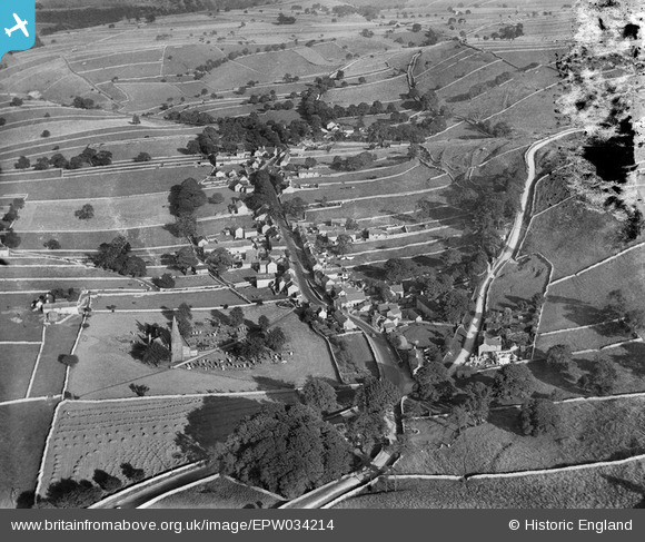
EPW034214 ENGLAND (1930). St Michael's Church, the village and surrounding fields, Taddington, 1930
© Copyright OpenStreetMap contributors and licensed by the OpenStreetMap Foundation. 2026. Cartography is licensed as CC BY-SA.
Nearby Images (3)
EPW034214

EPW034215

EPW034213

Details
| Title | [EPW034214] St Michael's Church, the village and surrounding fields, Taddington, 1930 |
| Reference | EPW034214 |
| Date | July-1930 |
| Link | |
| Place name | TADDINGTON |
| Parish | TADDINGTON |
| District | |
| Country | ENGLAND |
| Easting / Northing | 414262, 371050 |
| Longitude / Latitude | -1.786296648883, 53.236009668503 |
| National Grid Reference | SK143711 |
Pins
Be the first to add a comment to this image!