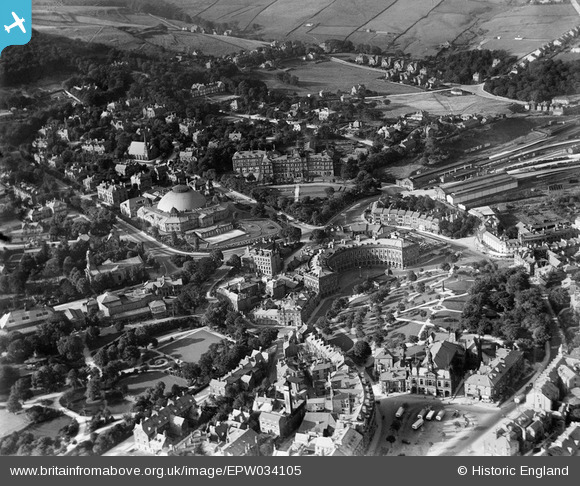
EPW034105 ENGLAND (1930). The town centre including the Devonshire Hospital, The Crescent and the Town Hall, Buxton, 1930
© Copyright OpenStreetMap contributors and licensed by the OpenStreetMap Foundation. 2026. Cartography is licensed as CC BY-SA.
Nearby Images (6)
Details
| Title | [EPW034105] The town centre including the Devonshire Hospital, The Crescent and the Town Hall, Buxton, 1930 |
| Reference | EPW034105 |
| Date | July-1930 |
| Link | |
| Place name | BUXTON |
| Parish | |
| District | |
| Country | ENGLAND |
| Easting / Northing | 405743, 373641 |
| Longitude / Latitude | -1.9138992463288, 53.259462814473 |
| National Grid Reference | SK057736 |
Pins

Nick Hambleton |
Sunday 26th of July 2015 03:05:45 PM | |

Judy B |
Sunday 1st of March 2015 05:47:23 PM |


![[EPW034105] The town centre including the Devonshire Hospital, The Crescent and the Town Hall, Buxton, 1930](http://britainfromabove.org.uk/sites/all/libraries/aerofilms-images/public/100x100/EPW/034/EPW034105.jpg)
![[EPW034113] The Crescent, The Park and environs, Buxton, 1930](http://britainfromabove.org.uk/sites/all/libraries/aerofilms-images/public/100x100/EPW/034/EPW034113.jpg)
![[EPW018989] The Devonshire Dome and Palace Hotel, Buxton, 1927](http://britainfromabove.org.uk/sites/all/libraries/aerofilms-images/public/100x100/EPW/018/EPW018989.jpg)
![[EPW034106] The Devonshire Hospital, the Palace Hotel and St John's Church, Buxton, 1930](http://britainfromabove.org.uk/sites/all/libraries/aerofilms-images/public/100x100/EPW/034/EPW034106.jpg)
![[EPW018991] The Crescent, Buxton, 1927](http://britainfromabove.org.uk/sites/all/libraries/aerofilms-images/public/100x100/EPW/018/EPW018991.jpg)
![[EPW018990] The Palace Hotel, Buxton, 1927](http://britainfromabove.org.uk/sites/all/libraries/aerofilms-images/public/100x100/EPW/018/EPW018990.jpg)