
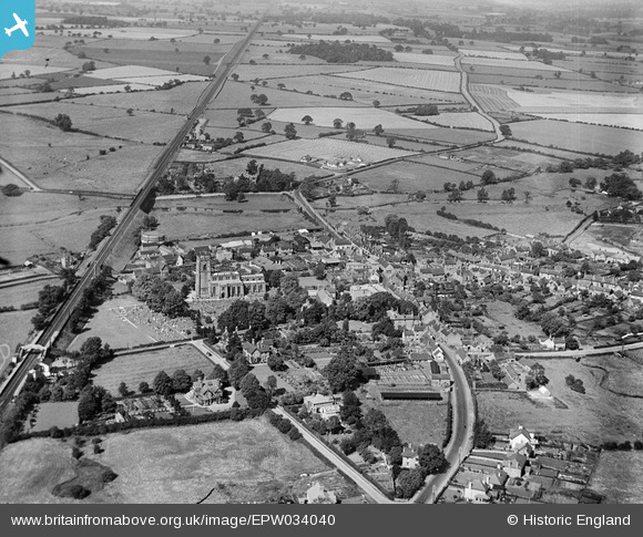
EPW034040 ENGLAND (1930). St Michael and All Angels' Church, the town and surrounding countryside, Penkridge, 1930
© Copyright OpenStreetMap contributors and licensed by the OpenStreetMap Foundation. 2025. Cartography is licensed as CC BY-SA.
Nearby Images (2)
EPW034040

EPW034041

Details
| Title | [EPW034040] St Michael and All Angels' Church, the town and surrounding countryside, Penkridge, 1930 |
| Reference | EPW034040 |
| Date | July-1930 |
| Link | |
| Place name | PENKRIDGE |
| Parish | PENKRIDGE |
| District | |
| Country | ENGLAND |
| Easting / Northing | 392224, 314276 |
| Longitude / Latitude | -2.1151516294714, 52.725733063046 |
| National Grid Reference | SJ922143 |
Pins

bescotbeast |
Tuesday 3rd of June 2014 07:44:50 AM | |
|
bescotbeast |
Tuesday 3rd of June 2014 07:44:04 AM | |
|
bescotbeast |
Tuesday 3rd of June 2014 07:42:12 AM | |
|
bescotbeast |
Tuesday 3rd of June 2014 07:40:43 AM | |
|
bescotbeast |
Tuesday 3rd of June 2014 07:40:21 AM | |
The viaduct over the Penk is 7 arches - http://www.penkridge.org.uk/P1010024%20(Small).JPG |

Andy Y |
Friday 28th of November 2014 07:38:07 PM |
|
bescotbeast |
Tuesday 3rd of June 2014 07:39:38 AM | |
|
bescotbeast |
Tuesday 3rd of June 2014 07:37:54 AM |