
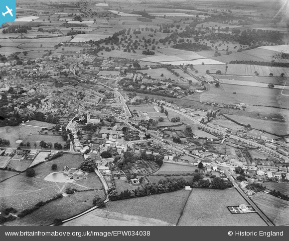
EPW034038 ENGLAND (1930). The town and surrounding countryside, Wellington, 1930
© Copyright OpenStreetMap contributors and licensed by the OpenStreetMap Foundation. 2026. Cartography is licensed as CC BY-SA.
Nearby Images (3)
EPW034038

EPW034035

EAW008047

Details
| Title | [EPW034038] The town and surrounding countryside, Wellington, 1930 |
| Reference | EPW034038 |
| Date | July-1930 |
| Link | |
| Place name | WELLINGTON |
| Parish | WELLINGTON |
| District | |
| Country | ENGLAND |
| Easting / Northing | 365639, 311368 |
| Longitude / Latitude | -2.5085236696732, 52.698553612736 |
| National Grid Reference | SJ656114 |
Pins

whiston |
Monday 8th of July 2013 10:36:22 PM | |
|
whiston |
Monday 8th of July 2013 10:34:09 PM | |
|
whiston |
Monday 8th of July 2013 10:25:07 PM | |
|
whiston |
Monday 8th of July 2013 10:22:23 PM | |
|
whiston |
Monday 8th of July 2013 08:51:34 PM |