
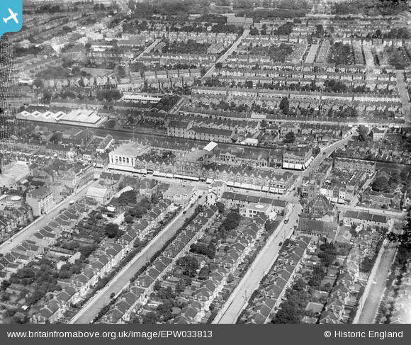
EPW033813 ENGLAND (1930). High Road and environs, Ilford, 1930
© Copyright OpenStreetMap contributors and licensed by the OpenStreetMap Foundation. 2026. Cartography is licensed as CC BY-SA.
Nearby Images (7)
EPW033813

EPW033817

EPW033812

EPW033811

EPW033816

EPW033815

EPW033814

Details
| Title | [EPW033813] High Road and environs, Ilford, 1930 |
| Reference | EPW033813 |
| Date | July-1930 |
| Link | |
| Place name | ILFORD |
| Parish | |
| District | |
| Country | ENGLAND |
| Easting / Northing | 543949, 186572 |
| Longitude / Latitude | 0.076804089955957, 51.559158657195 |
| National Grid Reference | TQ439866 |
Pins

Hermann the German |
Wednesday 17th of October 2018 09:03:46 PM | |
|
Hermann the German |
Wednesday 17th of October 2018 08:57:18 PM | |
|
Hermann the German |
Wednesday 17th of October 2018 08:56:35 PM | |
|
Dennis Jackson |
Thursday 23rd of June 2016 04:41:48 PM | |
|
Dennis Jackson |
Thursday 23rd of June 2016 04:39:56 PM | |
|
Dennis Jackson |
Thursday 23rd of June 2016 04:39:08 PM |