
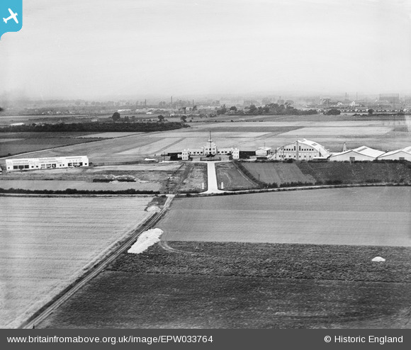
EPW033764 ENGLAND (1930). Heston Air Park, Heston, from the south, 1930
© Copyright OpenStreetMap contributors and licensed by the OpenStreetMap Foundation. 2026. Cartography is licensed as CC BY-SA.
Nearby Images (9)
EPW033764

EPW033765

EPW034872

EPW060955

EPW037341

EPW035082

EPW037939

EPW033756

EPW028213

Details
| Title | [EPW033764] Heston Air Park, Heston, from the south, 1930 |
| Reference | EPW033764 |
| Date | July-1930 |
| Link | |
| Place name | HESTON |
| Parish | |
| District | |
| Country | ENGLAND |
| Easting / Northing | 511357, 177299 |
| Longitude / Latitude | -0.39611617881318, 51.483182623523 |
| National Grid Reference | TQ114773 |
Pins
Be the first to add a comment to this image!