
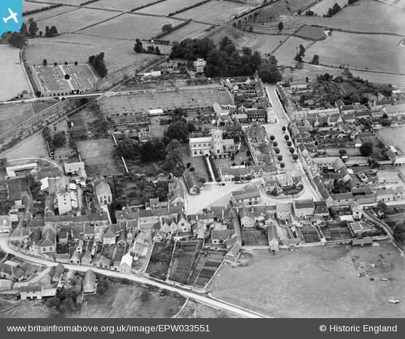
EPW033551 ENGLAND (1930). St Michael's Church and the town centre, Somerton, 1930
© Copyright OpenStreetMap contributors and licensed by the OpenStreetMap Foundation. 2025. Cartography is licensed as CC BY-SA.
Nearby Images (3)
EPW033551

EPW054772

EPW033550

Details
| Title | [EPW033551] St Michael's Church and the town centre, Somerton, 1930 |
| Reference | EPW033551 |
| Date | July-1930 |
| Link | |
| Place name | SOMERTON |
| Parish | SOMERTON |
| District | |
| Country | ENGLAND |
| Easting / Northing | 349030, 128601 |
| Longitude / Latitude | -2.7273005126269, 51.053953572468 |
| National Grid Reference | ST490286 |
Pins

Class31 |
Friday 24th of January 2014 01:34:58 PM | |
|
Class31 |
Friday 24th of January 2014 12:49:02 PM | |
|
Class31 |
Friday 24th of January 2014 12:44:17 PM | |

MB |
Friday 29th of March 2013 06:40:11 PM | |
|
MB |
Friday 29th of March 2013 06:39:39 PM | |
|
MB |
Friday 29th of March 2013 06:39:09 PM | |
|
MB |
Friday 29th of March 2013 06:38:47 PM | |
|
MB |
Friday 29th of March 2013 06:38:13 PM | |
|
MB |
Friday 29th of March 2013 06:37:53 PM | |
|
MB |
Friday 29th of March 2013 06:36:11 PM | |
|
MB |
Friday 29th of March 2013 06:34:44 PM | |
|
MB |
Friday 29th of March 2013 06:31:56 PM | |
|
MB |
Friday 29th of March 2013 06:31:15 PM |


