
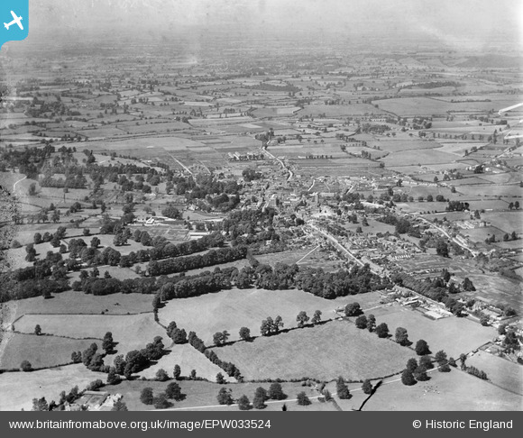
EPW033524 ENGLAND (1930). The town, Calne, from the south-east, 1930
© Copyright OpenStreetMap contributors and licensed by the OpenStreetMap Foundation. 2026. Cartography is licensed as CC BY-SA.
Nearby Images (2)
EPW033524

EPW033525

Details
| Title | [EPW033524] The town, Calne, from the south-east, 1930 |
| Reference | EPW033524 |
| Date | July-1930 |
| Link | |
| Place name | CALNE |
| Parish | CALNE |
| District | |
| Country | ENGLAND |
| Easting / Northing | 400045, 169840 |
| Longitude / Latitude | -1.9993526743675, 51.427074693621 |
| National Grid Reference | SU000698 |
Pins

Steve Bedding |
Monday 3rd of June 2013 10:08:47 PM |