
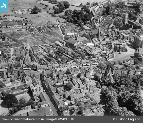
EPW033518 ENGLAND (1930). The High Street, Calne, 1930
© Copyright OpenStreetMap contributors and licensed by the OpenStreetMap Foundation. 2026. Cartography is licensed as CC BY-SA.
Nearby Images (25)
EPW033518

EPW029293

EPW011113

EPW033526

EPW033517

EPW011112

EPR000046
 Ltd Bacon Factory and the town centre, Calne, 1934")
EPW033516

EPR000048
 Ltd Bacon Factory and the town centre, Calne, 1934")
EPW029300

EPW029299

EPR000047
 Ltd Bacon Factory and the town centre, Calne, 1934")
EPW033515

EPW029297

EPW011115

EPW029289

EPW029302

EPW001116

EPW029298

EPW029294

EPW033520

EPW033521

EPW029296

EPW001114

EPW029288

Details
| Title | [EPW033518] The High Street, Calne, 1930 |
| Reference | EPW033518 |
| Date | July-1930 |
| Link | |
| Place name | CALNE |
| Parish | CALNE |
| District | |
| Country | ENGLAND |
| Easting / Northing | 399745, 171091 |
| Longitude / Latitude | -2.0036690796125, 51.438324393724 |
| National Grid Reference | ST997711 |


