
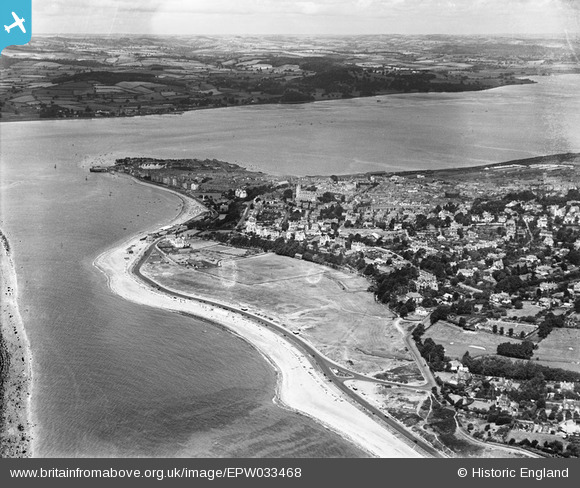
EPW033468 ENGLAND (1930). The Maer, the town and the River Exe, Exmouth, from the south-east, 1930
© Copyright OpenStreetMap contributors and licensed by the OpenStreetMap Foundation. 2026. Cartography is licensed as CC BY-SA.
Nearby Images (2)
EPW033468

EPW039697

Details
| Title | [EPW033468] The Maer, the town and the River Exe, Exmouth, from the south-east, 1930 |
| Reference | EPW033468 |
| Date | July-1930 |
| Link | |
| Place name | EXMOUTH |
| Parish | EXMOUTH |
| District | |
| Country | ENGLAND |
| Easting / Northing | 300958, 80037 |
| Longitude / Latitude | -3.399956194623, 50.611043306858 |
| National Grid Reference | SY010800 |
Pins

John Llewellyn |
Wednesday 24th of June 2020 02:41:04 PM | |
|
ElTel |
Saturday 15th of November 2014 01:37:40 AM | |

Class31 |
Wednesday 19th of June 2013 10:22:44 PM | |
|
Class31 |
Wednesday 19th of June 2013 10:20:32 PM |

