
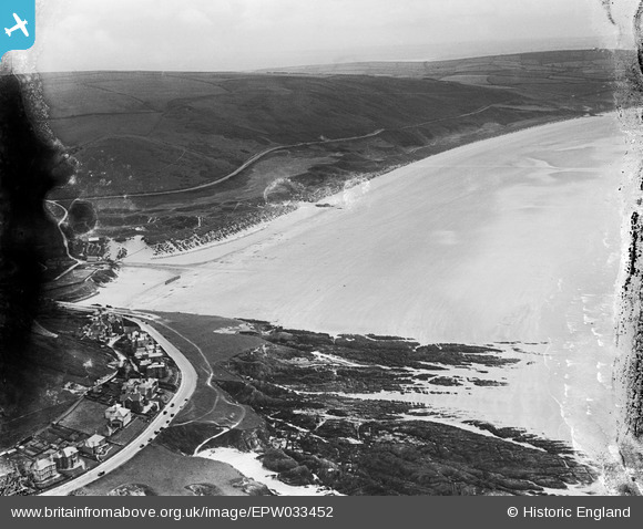
EPW033452 ENGLAND (1930). Shellsborough Cove, Woolacombe Sand and Woolacombe Down, Woolacombe, from the north-west, 1930. This image has been produced from a damaged negative.
© Copyright OpenStreetMap contributors and licensed by the OpenStreetMap Foundation. 2026. Cartography is licensed as CC BY-SA.
Nearby Images (2)
EPW033452

EPW039872

Details
| Title | [EPW033452] Shellsborough Cove, Woolacombe Sand and Woolacombe Down, Woolacombe, from the north-west, 1930. This image has been produced from a damaged negative. |
| Reference | EPW033452 |
| Date | July-1930 |
| Link | |
| Place name | WOOLACOMBE |
| Parish | MORTEHOE |
| District | |
| Country | ENGLAND |
| Easting / Northing | 245379, 143921 |
| Longitude / Latitude | -4.2121005919377, 51.173074121822 |
| National Grid Reference | SS454439 |
Pins
Be the first to add a comment to this image!