
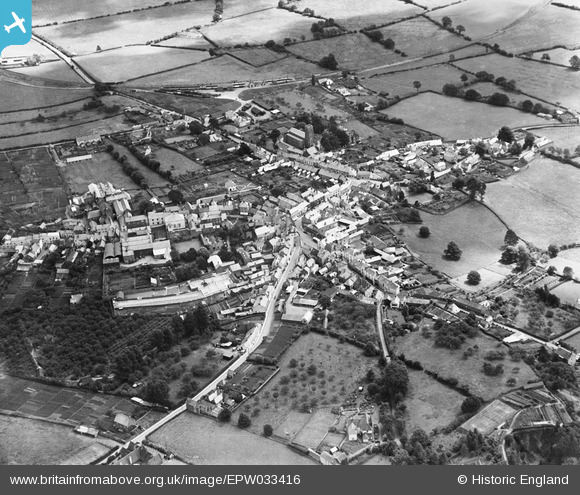
EPW033416 ENGLAND (1930). The town, Wiveliscombe, 1930
© Copyright OpenStreetMap contributors and licensed by the OpenStreetMap Foundation. 2025. Cartography is licensed as CC BY-SA.
Nearby Images (4)
EPW033416

EPW033417

EPW033414

EPW033415

Details
| Title | [EPW033416] The town, Wiveliscombe, 1930 |
| Reference | EPW033416 |
| Date | July-1930 |
| Link | |
| Place name | WIVELISCOMBE |
| Parish | WIVELISCOMBE |
| District | |
| Country | ENGLAND |
| Easting / Northing | 308084, 127830 |
| Longitude / Latitude | -3.31124357158, 51.041926747883 |
| National Grid Reference | ST081278 |
Pins

alastair wallace |
Monday 15th of July 2019 01:34:01 PM |