
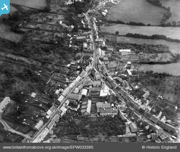
EPW033385 ENGLAND (1930). The Town Hall and East Street, Bovey Tracey, 1930
© Copyright OpenStreetMap contributors and licensed by the OpenStreetMap Foundation. 2026. Cartography is licensed as CC BY-SA.
Nearby Images (3)
EPW033385

EPW033388

EPW033386

Details
| Title | [EPW033385] The Town Hall and East Street, Bovey Tracey, 1930 |
| Reference | EPW033385 |
| Date | July-1930 |
| Link | |
| Place name | BOVEY TRACEY |
| Parish | BOVEY TRACEY |
| District | |
| Country | ENGLAND |
| Easting / Northing | 281740, 78583 |
| Longitude / Latitude | -3.6710259027596, 50.594391764385 |
| National Grid Reference | SX817786 |
Pins
Be the first to add a comment to this image!