
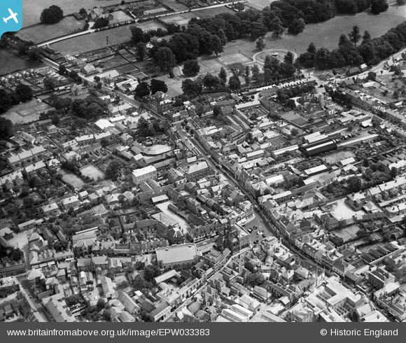
EPW033383 ENGLAND (1930). The Market Place, London Street and the War Memorial Park, Basingstoke, 1930
© Copyright OpenStreetMap contributors and licensed by the OpenStreetMap Foundation. 2026. Cartography is licensed as CC BY-SA.
Nearby Images (7)
EPW033383

EPW011141

EPW022758

EPW022694

EPW011142

EPW022760

EPW022755

Details
| Title | [EPW033383] The Market Place, London Street and the War Memorial Park, Basingstoke, 1930 |
| Reference | EPW033383 |
| Date | July-1930 |
| Link | |
| Place name | BASINGSTOKE |
| Parish | |
| District | |
| Country | ENGLAND |
| Easting / Northing | 463900, 151876 |
| Longitude / Latitude | -1.0840865818765, 51.261946270708 |
| National Grid Reference | SU639519 |
Pins

Sara |
Thursday 29th of February 2024 06:09:05 PM | |
|
Sara |
Thursday 29th of February 2024 06:07:26 PM | |
|
Tim |
Monday 4th of May 2020 10:05:53 AM | |
|
David960 |
Wednesday 4th of February 2015 07:32:41 PM | |
|
David960 |
Wednesday 4th of February 2015 07:24:58 PM | |
|
David960 |
Wednesday 4th of February 2015 07:22:00 PM | |
|
David960 |
Wednesday 4th of February 2015 07:20:01 PM | |
|
Dockgreen |
Monday 29th of December 2014 09:59:46 PM | |
|
spodgrim |
Sunday 16th of June 2013 04:01:20 PM | |
|
mcgeacs |
Sunday 17th of March 2013 07:32:42 PM |