
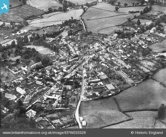
EPW033328 ENGLAND (1930). The town, Chudleigh, from the north, 1930
© Copyright OpenStreetMap contributors and licensed by the OpenStreetMap Foundation. 2025. Cartography is licensed as CC BY-SA.
Nearby Images (2)
EPW033328

EPW033325

Details
| Title | [EPW033328] The town, Chudleigh, from the north, 1930 |
| Reference | EPW033328 |
| Date | July-1930 |
| Link | |
| Place name | CHUDLEIGH |
| Parish | CHUDLEIGH |
| District | |
| Country | ENGLAND |
| Easting / Northing | 286844, 79803 |
| Longitude / Latitude | -3.5993082378627, 50.606372054347 |
| National Grid Reference | SX868798 |
Pins

MB |
Wednesday 20th of January 2021 08:11:12 PM | |
|
MB |
Wednesday 20th of January 2021 08:10:07 PM | |
|
MB |
Wednesday 20th of January 2021 08:09:25 PM | |
|
MB |
Wednesday 20th of January 2021 08:08:17 PM | |
|
MB |
Wednesday 20th of January 2021 08:07:39 PM | |
|
MB |
Wednesday 20th of January 2021 08:07:15 PM | |
|
MB |
Wednesday 20th of January 2021 08:06:49 PM | |
|
MB |
Wednesday 20th of January 2021 08:05:46 PM | |
|
MB |
Wednesday 20th of January 2021 08:05:07 PM |