
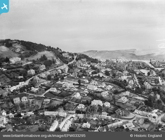
EPW033295 ENGLAND (1930). Higher Town, Minehead, from the south-west, 1930
© Copyright OpenStreetMap contributors and licensed by the OpenStreetMap Foundation. 2025. Cartography is licensed as CC BY-SA.
Nearby Images (2)
EPW033295

EPW033297

Details
| Title | [EPW033295] Higher Town, Minehead, from the south-west, 1930 |
| Reference | EPW033295 |
| Date | July-1930 |
| Link | |
| Place name | MINEHEAD |
| Parish | MINEHEAD |
| District | |
| Country | ENGLAND |
| Easting / Northing | 296797, 146640 |
| Longitude / Latitude | -3.4775929081504, 51.20911351048 |
| National Grid Reference | SS968466 |
Pins
Be the first to add a comment to this image!