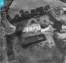
EPW033249 ENGLAND (1930). Barton, Buckland Brewer, 1930
© Copyright OpenStreetMap contributors and licensed by the OpenStreetMap Foundation. 2026. Cartography is licensed as CC BY-SA.
Details
| Title | [EPW033249] Barton, Buckland Brewer, 1930 |
| Reference | EPW033249 |
| Date | July-1930 |
| Link | |
| Place name | BUCKLAND BREWER |
| Parish | BUCKLAND BREWER |
| District | |
| Country | ENGLAND |
| Easting / Northing | 241476, 120734 |
| Longitude / Latitude | -4.2577280386311, 50.963643455824 |
| National Grid Reference | SS415207 |
Pins

Billy Turner |
Saturday 18th of June 2016 12:20:40 AM | |

BigglesH |
Monday 24th of June 2013 01:13:07 PM | |

BigglesH |
Monday 24th of June 2013 01:10:18 PM | |

MB |
Saturday 15th of December 2012 11:13:05 AM |
User Comment Contributions
This property is the Barton at Buckland Brewer, North Devon. |

c |
Tuesday 3rd of September 2013 03:46:41 PM |
Great another one found - well done |

Dave Brunt |
Saturday 31st of August 2013 08:43:09 AM |
Hi c, Thanks for your suggestion! We'll update the catalogue and post your new data here in due course. Yours, Katy Britain from Above Cataloguing Team Leader |
Katy Whitaker |
Tuesday 3rd of September 2013 03:46:41 PM |
View is looking north. Another impressive spot C, well done. |

Class31 |
Saturday 31st of August 2013 11:50:08 PM |
This is a very substantial farm - see large yard to right The use of stone (as well as possible cob in the house) suggests a west Devon location |

Nat |
Saturday 24th of August 2013 10:14:06 AM |

Alan McFarlane |
Monday 27th of May 2013 06:26:08 AM | |
See also EPW033248. |

BigglesH |
Sunday 14th of April 2013 08:03:51 PM |
This has a real Devon feel about it. It neighbour numbers are Luscombe Castle, Dawlish which offers no glue in the immediate vicinity from the study of modern aerial pictures. The mixture of whitewash, stone out buildings and what at least in part appears to be cob under thatch, suggests somewhere on the edge of Dartmoor or north Devon. Clearly the householders had time to get 'on parade' but the workers by the beehives beyond the barns seem less involved with the picture taking. It is clearly a go ahead enterprise with its large wooden chicken houses near the house and some smaller ones out in the fields. The house could be a modernised Devon long house, many of which tend to be orientated with the ridge from east to west the fron facing south... but there are not shadows to tell us this. |

Maurice |
Thursday 20th of December 2012 04:07:05 PM |
The farmhouse with slate roof, barns with thatched roofs and the nineteenth century barn by the sheep and hens are all types I associate with the south west - in particular west Devon and perhaps also east Cornwall. Is west Wales also a candidate? |

MB |
Saturday 15th of December 2012 11:18:14 AM |


![[EPW033249] Barton, Buckland Brewer, 1930](http://britainfromabove.org.uk/sites/all/libraries/aerofilms-images/public/100x100/EPW/033/EPW033249.jpg)
![[EPW033248] Barton, Buckland Brewer, 1930](http://britainfromabove.org.uk/sites/all/libraries/aerofilms-images/public/100x100/EPW/033/EPW033248.jpg)

