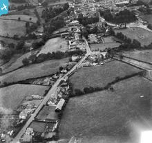
EPW033128 ENGLAND (1930). Canal Road and the town, Holsworthy, from the north, 1930
© Copyright OpenStreetMap contributors and licensed by the OpenStreetMap Foundation. 2026. Cartography is licensed as CC BY-SA.
Details
| Title | [EPW033128] Canal Road and the town, Holsworthy, from the north, 1930 |
| Reference | EPW033128 |
| Date | July-1930 |
| Link | |
| Place name | HOLSWORTHY |
| Parish | HOLSWORTHY |
| District | |
| Country | ENGLAND |
| Easting / Northing | 234456, 104343 |
| Longitude / Latitude | -4.3501925628504, 50.814381801936 |
| National Grid Reference | SS345043 |
Pins

Class31 |
Saturday 22nd of December 2012 06:07:46 AM | |

Class31 |
Saturday 22nd of December 2012 06:07:04 AM | |
Holsworthy Viaduct opened in 1879 said to be the first of it's kind constructed entirely of concrete. |

Class31 |
Saturday 22nd of December 2012 07:21:02 AM |
Holsworth east Viaduct is natural stone. Derriton Viaduct to the west of the town on the Bude extension is the concrete one. See EPW033130 |

Maurice |
Saturday 22nd of December 2012 08:32:12 AM |

Class31 |
Saturday 22nd of December 2012 06:06:06 AM | |

Class31 |
Saturday 22nd of December 2012 06:01:55 AM | |

Class31 |
Saturday 22nd of December 2012 05:55:31 AM | |

Class31 |
Saturday 22nd of December 2012 05:54:06 AM | |

Class31 |
Saturday 22nd of December 2012 05:51:54 AM |


