
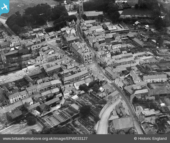
EPW033127 ENGLAND (1930). Stanhope Square and the town centre, Holsworthy, 1930
© Copyright OpenStreetMap contributors and licensed by the OpenStreetMap Foundation. 2026. Cartography is licensed as CC BY-SA.
Nearby Images (4)
EPW033127

EPW033124

EPW033126

EPW033125

Details
| Title | [EPW033127] Stanhope Square and the town centre, Holsworthy, 1930 |
| Reference | EPW033127 |
| Date | July-1930 |
| Link | |
| Place name | HOLSWORTHY |
| Parish | HOLSWORTHY |
| District | |
| Country | ENGLAND |
| Easting / Northing | 234319, 103731 |
| Longitude / Latitude | -4.3518594443517, 50.808843201603 |
| National Grid Reference | SS343037 |
Pins

Class31 |
Saturday 22nd of December 2012 07:55:35 PM | |
|
Class31 |
Saturday 22nd of December 2012 07:54:57 PM | |
|
Class31 |
Saturday 22nd of December 2012 07:53:55 PM | |
|
Class31 |
Saturday 22nd of December 2012 07:53:35 PM | |
|
Class31 |
Saturday 22nd of December 2012 07:53:17 PM | |
|
Class31 |
Saturday 22nd of December 2012 07:52:58 PM |
User Comment Contributions

Stanhope Square, Holsworthy, 17/10/2016 |
Class31 |
Thursday 20th of October 2016 09:06:38 AM |