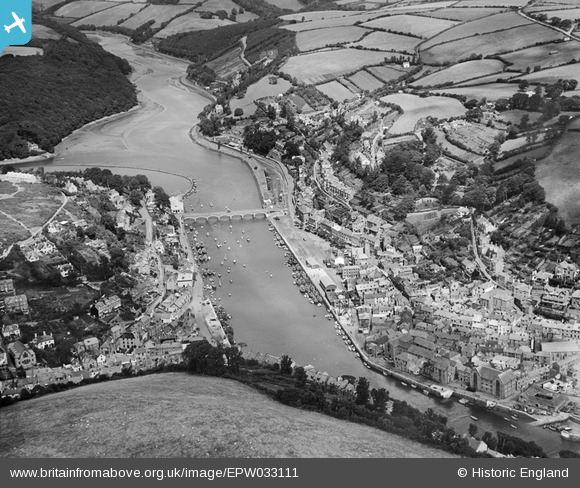
EPW033111 ENGLAND (1930). Looe Harbour and environs, East Looe, 1930
© Copyright OpenStreetMap contributors and licensed by the OpenStreetMap Foundation. 2026. Cartography is licensed as CC BY-SA.
Nearby Images (6)
Details
| Title | [EPW033111] Looe Harbour and environs, East Looe, 1930 |
| Reference | EPW033111 |
| Date | July-1930 |
| Link | |
| Place name | EAST LOOE |
| Parish | LOOE |
| District | |
| Country | ENGLAND |
| Easting / Northing | 225455, 53526 |
| Longitude / Latitude | -4.4539922348464, 50.355118621357 |
| National Grid Reference | SX255535 |


![[EPW033111] Looe Harbour and environs, East Looe, 1930](http://britainfromabove.org.uk/sites/all/libraries/aerofilms-images/public/100x100/EPW/033/EPW033111.jpg)
![[EPW033110] The bridge between East and West Looe and environs, East Looe, 1930](http://britainfromabove.org.uk/sites/all/libraries/aerofilms-images/public/100x100/EPW/033/EPW033110.jpg)
![[EAW020277] East Looe looking out to sea, Looe, from the north-west, 1948](http://britainfromabove.org.uk/sites/all/libraries/aerofilms-images/public/100x100/EAW/020/EAW020277.jpg)
![[EAW051357] The town, Looe, 1953](http://britainfromabove.org.uk/sites/all/libraries/aerofilms-images/public/100x100/EAW/051/EAW051357.jpg)
![[EPW033108] Looe Harbour and environs, East Looe, 1930](http://britainfromabove.org.uk/sites/all/libraries/aerofilms-images/public/100x100/EPW/033/EPW033108.jpg)
![[EAW277527] The beach, harbour and town, East Looe, 1974](http://britainfromabove.org.uk/sites/all/libraries/aerofilms-images/public/100x100/EAW/277/EAW277527.jpg)
