
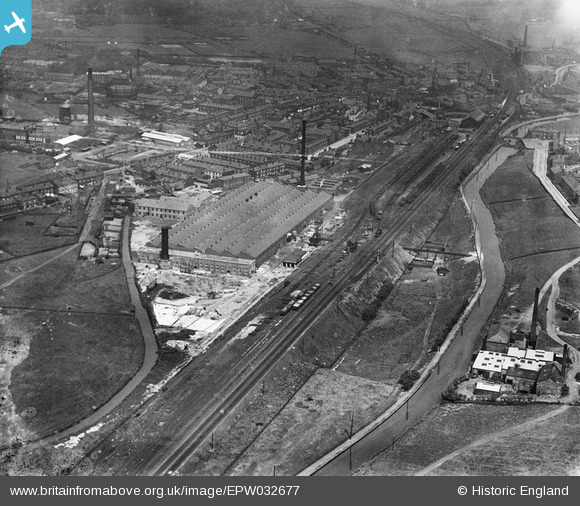
EPW032677 ENGLAND (1930). Atlas Artificial Silk, Littleborough, 1930
© Copyright OpenStreetMap contributors and licensed by the OpenStreetMap Foundation. 2026. Cartography is licensed as CC BY-SA.
Nearby Images (9)
EPW032677

EPW032672

EPW032670

EPW032675

EPW032671

EPW013232

EPW032676

EPW032674

EPW013230

Details
| Title | [EPW032677] Atlas Artificial Silk, Littleborough, 1930 |
| Reference | EPW032677 |
| Date | June-1930 |
| Link | |
| Place name | LITTLEBOROUGH |
| Parish | |
| District | |
| Country | ENGLAND |
| Easting / Northing | 393403, 415999 |
| Longitude / Latitude | -2.099792691896, 53.640231132852 |
| National Grid Reference | SD934160 |
Pins

wadey |
Thursday 4th of December 2014 04:13:59 PM |
User Comment Contributions
Who ran this plant, what was the product, Acetate or viscose and was it yarn production or processing? Triggy. Dave Trigg. Derby. |
Triggy |
Wednesday 12th of February 2014 02:46:55 PM |