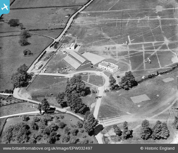
EPW032497 ENGLAND (1930). Bristol Whitchurch Airport, Hengrove, 1930
© Copyright OpenStreetMap contributors and licensed by the OpenStreetMap Foundation. 2026. Cartography is licensed as CC BY-SA.
Details
| Title | [EPW032497] Bristol Whitchurch Airport, Hengrove, 1930 |
| Reference | EPW032497 |
| Date | June-1930 |
| Link | |
| Place name | HENGROVE |
| Parish | |
| District | |
| Country | ENGLAND |
| Easting / Northing | 359819, 167895 |
| Longitude / Latitude | -2.5777679068892, 51.40816004015 |
| National Grid Reference | ST598679 |
Pins

pe175 |
Thursday 13th of December 2012 11:51:23 AM | |

pe175 |
Thursday 13th of December 2012 11:48:58 AM | |

pe175 |
Thursday 13th of December 2012 11:46:24 AM | |

pe175 |
Thursday 13th of December 2012 11:45:47 AM | |

pe175 |
Thursday 13th of December 2012 11:45:17 AM | |

pe175 |
Thursday 13th of December 2012 11:43:56 AM | |

pe175 |
Thursday 13th of December 2012 11:43:20 AM | |

pe175 |
Thursday 13th of December 2012 11:42:44 AM |


![[EPW032497] Bristol Whitchurch Airport, Hengrove, 1930](http://britainfromabove.org.uk/sites/all/libraries/aerofilms-images/public/100x100/EPW/032/EPW032497.jpg)
![[EPW032498] Bristol Whitchurch Airport, Hengrove, from the south, 1930](http://britainfromabove.org.uk/sites/all/libraries/aerofilms-images/public/100x100/EPW/032/EPW032498.jpg)
![[EPW048431] Bristol (Whitchurch) Airport, Hengrove, 1935](http://britainfromabove.org.uk/sites/all/libraries/aerofilms-images/public/100x100/EPW/048/EPW048431.jpg)
![[EPW032499] Bristol Whitchurch Airport, Hengrove, from the south-east, 1930](http://britainfromabove.org.uk/sites/all/libraries/aerofilms-images/public/100x100/EPW/032/EPW032499.jpg)