
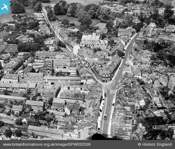
EPW032338 ENGLAND (1930). The junction of Salisbury Street and White Cliff Mill Street, Blandford Forum, 1930
© Copyright OpenStreetMap contributors and licensed by the OpenStreetMap Foundation. 2026. Cartography is licensed as CC BY-SA.
Nearby Images (9)
EPW032338

EAW049974

EAW049976

EPW032340

EPW032337

EPW032339

EAW049975

EPW032335

EPW032336

Details
| Title | [EPW032338] The junction of Salisbury Street and White Cliff Mill Street, Blandford Forum, 1930 |
| Reference | EPW032338 |
| Date | June-1930 |
| Link | |
| Place name | BLANDFORD FORUM |
| Parish | BLANDFORD FORUM |
| District | |
| Country | ENGLAND |
| Easting / Northing | 388452, 106434 |
| Longitude / Latitude | -2.164083765735, 50.856745516672 |
| National Grid Reference | ST885064 |
Pins

alastair wallace |
Monday 19th of October 2015 07:23:51 PM | |

Class31 |
Saturday 6th of July 2013 10:13:22 PM | |
|
Class31 |
Saturday 6th of July 2013 10:10:11 PM | |
David Parry |
Tuesday 5th of February 2013 04:36:24 PM | |
David Parry |
Tuesday 5th of February 2013 04:35:49 PM |


