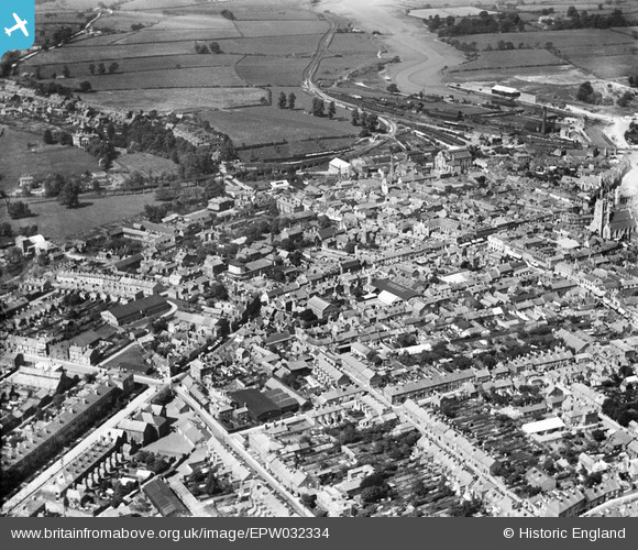
EPW032334 ENGLAND (1930). The town centre, Newport, 1930
© Copyright OpenStreetMap contributors and licensed by the OpenStreetMap Foundation. 2026. Cartography is licensed as CC BY-SA.
Nearby Images (6)
Details
| Title | [EPW032334] The town centre, Newport, 1930 |
| Reference | EPW032334 |
| Date | June-1930 |
| Link | |
| Place name | NEWPORT |
| Parish | NEWPORT |
| District | |
| Country | ENGLAND |
| Easting / Northing | 449717, 89150 |
| Longitude / Latitude | -1.2959435711938, 50.699289196297 |
| National Grid Reference | SZ497892 |
Pins

steve |
Sunday 13th of January 2013 08:29:03 PM |


![[EPW032334] The town centre, Newport, 1930](http://britainfromabove.org.uk/sites/all/libraries/aerofilms-images/public/100x100/EPW/032/EPW032334.jpg)
![[EPW023021] St James's Square, St Thomas's Church and environs, Newport, 1928. This image has been produced from a copy-negative.](http://britainfromabove.org.uk/sites/all/libraries/aerofilms-images/public/100x100/EPW/023/EPW023021.jpg)
![[EAW022225] The town, Newport, 1949](http://britainfromabove.org.uk/sites/all/libraries/aerofilms-images/public/100x100/EAW/022/EAW022225.jpg)
![[EPW032333] St Thomas's Church and the town centre, Newport, 1930](http://britainfromabove.org.uk/sites/all/libraries/aerofilms-images/public/100x100/EPW/032/EPW032333.jpg)
![[EPW032330] The town, Newport, 1930](http://britainfromabove.org.uk/sites/all/libraries/aerofilms-images/public/100x100/EPW/032/EPW032330.jpg)
![[EAW003000] The town and River Medina looking towards The Solent, Newport, from the south, 1946](http://britainfromabove.org.uk/sites/all/libraries/aerofilms-images/public/100x100/EAW/003/EAW003000.jpg)