
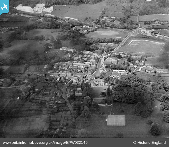
EPW032149 ENGLAND (1930). The village centre, Wrotham, 1930
© Copyright OpenStreetMap contributors and licensed by the OpenStreetMap Foundation. 2026. Cartography is licensed as CC BY-SA.
Nearby Images (6)
EPW032149

EPW032150

EPW026054

EPW032148

EPW026050

EPW026053

Details
| Title | [EPW032149] The village centre, Wrotham, 1930 |
| Reference | EPW032149 |
| Date | May-1930 |
| Link | |
| Place name | WROTHAM |
| Parish | WROTHAM |
| District | |
| Country | ENGLAND |
| Easting / Northing | 561120, 159147 |
| Longitude / Latitude | 0.31185140223396, 51.308094565678 |
| National Grid Reference | TQ611591 |
Pins
Be the first to add a comment to this image!