
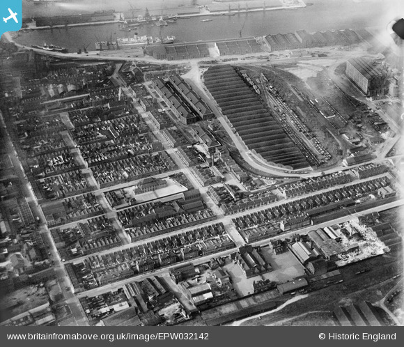
EPW032142 ENGLAND (1930). The Western Granaries and Grain Depot, Millwall, 1930
© Copyright OpenStreetMap contributors and licensed by the OpenStreetMap Foundation. 2026. Cartography is licensed as CC BY-SA.
Nearby Images (16)
EPW032142

EPW032137

EPW032139

EPW032143

EPW032141

EPW044128

EPW032140

EPW032138

EPW032136

EAW009114

EPW006141

EAW021721

EAW045810

EPW044135

EAW112904

EAW045808

Details
| Title | [EPW032142] The Western Granaries and Grain Depot, Millwall, 1930 |
| Reference | EPW032142 |
| Date | May-1930 |
| Link | |
| Place name | MILLWALL |
| Parish | |
| District | |
| Country | ENGLAND |
| Easting / Northing | 537359, 179540 |
| Longitude / Latitude | -0.02095254883359, 51.497605086109 |
| National Grid Reference | TQ374795 |
Pins
Be the first to add a comment to this image!
User Comment Contributions
Millwall Central School in middle of photo with large playground on Janet St side. Mentally Defective School is just to the left of it. The Tooke Arms is further to the left standing on the corner of Janet St and West Ferry Rd. The warehouse next to the pub is Roberts Warbler Steel Scockists |

PeterJames |
Saturday 20th of October 2012 11:36:30 PM |