
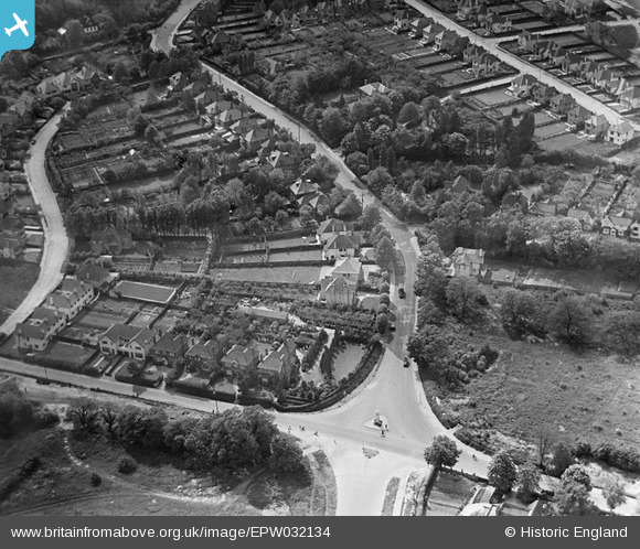
EPW032134 ENGLAND (1930). Station Road and the War Memorial, Orpington, 1930
© Copyright OpenStreetMap contributors and licensed by the OpenStreetMap Foundation. 2026. Cartography is licensed as CC BY-SA.
Nearby Images (2)
EPW032134

EPW032133

Details
| Title | [EPW032134] Station Road and the War Memorial, Orpington, 1930 |
| Reference | EPW032134 |
| Date | May-1930 |
| Link | |
| Place name | ORPINGTON |
| Parish | |
| District | |
| Country | ENGLAND |
| Easting / Northing | 545984, 165845 |
| Longitude / Latitude | 0.097581413570276, 51.37237230574 |
| National Grid Reference | TQ460658 |
Pins

Class31 |
Wednesday 7th of November 2012 04:19:04 PM | |
|
Class31 |
Wednesday 7th of November 2012 04:18:29 PM | |
|
Class31 |
Wednesday 7th of November 2012 04:17:43 PM | |
|
Class31 |
Wednesday 7th of November 2012 04:17:12 PM | |
|
Class31 |
Wednesday 7th of November 2012 04:16:42 PM | |
|
Class31 |
Wednesday 7th of November 2012 04:16:13 PM | |
|
Class31 |
Wednesday 7th of November 2012 04:15:48 PM | |
There are more details on this memorial at www.ukniwm.org.uk/server/show/conMemorial.3848/fromUkniwmSearch/1, but unfortunately no names of the soldiers. |

melgibbs |
Tuesday 7th of January 2014 08:52:40 PM |
|
Class31 |
Wednesday 7th of November 2012 04:13:55 PM |