
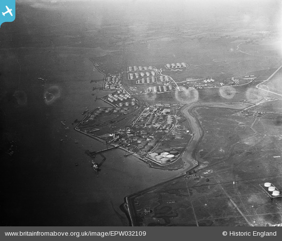
EPW032109 ENGLAND (1930). Shell Haven Oil Refinery and environs, Corringham, from the east, 1930
© Copyright OpenStreetMap contributors and licensed by the OpenStreetMap Foundation. 2026. Cartography is licensed as CC BY-SA.
Nearby Images (4)
EPW032109

EPW032110

EAW024608

EAW039899

Details
| Title | [EPW032109] Shell Haven Oil Refinery and environs, Corringham, from the east, 1930 |
| Reference | EPW032109 |
| Date | May-1930 |
| Link | |
| Place name | CORRINGHAM |
| Parish | |
| District | |
| Country | ENGLAND |
| Easting / Northing | 574957, 181820 |
| Longitude / Latitude | 0.52138121972686, 51.507702608053 |
| National Grid Reference | TQ750818 |
Pins
Be the first to add a comment to this image!