
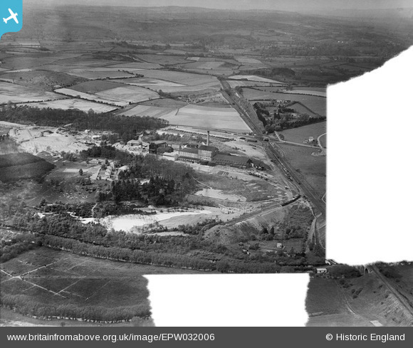
EPW032006 ENGLAND (1930). Anglo-Scottish Beet Sugar Factory and environs, Foley Park, from the east, 1930. This image was marked by Aerofilms Ltd for photo editing.
© Copyright OpenStreetMap contributors and licensed by the OpenStreetMap Foundation. 2026. Cartography is licensed as CC BY-SA.
Nearby Images (8)
EPW032006

EPW032010

EPW032004

EPW032001

EPW032005

EPW032011

EPW032007

EPW032002

Details
| Title | [EPW032006] Anglo-Scottish Beet Sugar Factory and environs, Foley Park, from the east, 1930. This image was marked by Aerofilms Ltd for photo editing. |
| Reference | EPW032006 |
| Date | May-1930 |
| Link | |
| Place name | FOLEY PARK |
| Parish | |
| District | |
| Country | ENGLAND |
| Easting / Northing | 382726, 274784 |
| Longitude / Latitude | -2.2537464642841, 52.370447818184 |
| National Grid Reference | SO827748 |
Pins

Class31 |
Wednesday 7th of November 2012 09:09:18 PM | |
|
Class31 |
Wednesday 7th of November 2012 08:31:43 PM | |
|
Class31 |
Wednesday 7th of November 2012 08:30:32 PM | |
|
Class31 |
Wednesday 7th of November 2012 08:29:03 PM | |
|
Class31 |
Wednesday 7th of November 2012 08:28:32 PM |