
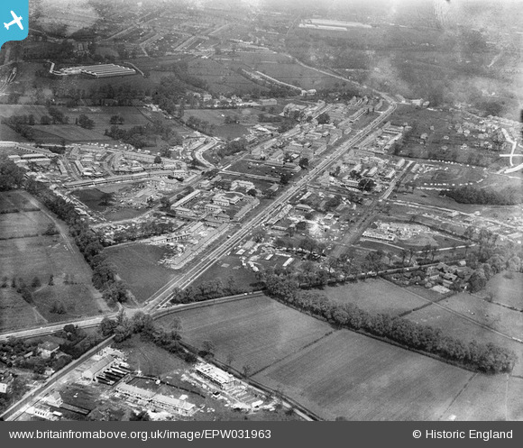
EPW031963 ENGLAND (1930). St Helier and environs, Morden, 1930
© Copyright OpenStreetMap contributors and licensed by the OpenStreetMap Foundation. 2026. Cartography is licensed as CC BY-SA.
Nearby Images (9)
EPW031963

EPW031961

EPW031960

EPW031967

EPW031962

EPW035584

EPW031966

EPW031810

EPW031814

Details
| Title | [EPW031963] St Helier and environs, Morden, 1930 |
| Reference | EPW031963 |
| Date | May-1930 |
| Link | |
| Place name | MORDEN |
| Parish | |
| District | |
| Country | ENGLAND |
| Easting / Northing | 526093, 167018 |
| Longitude / Latitude | -0.18764170423103, 51.387682198096 |
| National Grid Reference | TQ261670 |
Pins

DCAI |
Sunday 5th of October 2025 05:16:28 PM | |
|
DCAI |
Sunday 5th of October 2025 05:13:45 PM | |
|
DCAI |
Sunday 5th of October 2025 05:11:16 PM | |
|
DCAI |
Sunday 5th of October 2025 05:09:31 PM | |
|
DCAI |
Sunday 5th of October 2025 05:08:46 PM | |
|
DCAI |
Sunday 5th of October 2025 11:56:48 AM | |
|
DCAI |
Sunday 5th of October 2025 11:44:53 AM | |
|
DCAI |
Sunday 5th of October 2025 11:42:49 AM | |
|
DCAI |
Sunday 5th of October 2025 11:39:09 AM | |
|
DCAI |
Sunday 5th of October 2025 11:38:10 AM | |
|
DCAI |
Sunday 5th of October 2025 11:37:10 AM | |
|
DCAI |
Sunday 5th of October 2025 11:36:16 AM | |
|
DCAI |
Sunday 5th of October 2025 11:34:22 AM | |
|
DCAI |
Sunday 5th of October 2025 11:31:32 AM | |
|
DCAI |
Sunday 5th of October 2025 11:29:06 AM | |
|
DCAI |
Sunday 5th of October 2025 11:28:32 AM | |
|
DCAI |
Sunday 5th of October 2025 11:23:14 AM | |
|
DCAI |
Sunday 5th of October 2025 11:21:45 AM |