
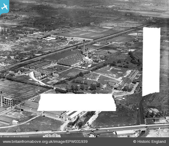
EPW031939 ENGLAND (1930). The Lissen Ltd Wireless Works and environs, Edmonton, 1930. This image was marked by Aerofilms Ltd for photo editing.
© Copyright OpenStreetMap contributors and licensed by the OpenStreetMap Foundation. 2026. Cartography is licensed as CC BY-SA.
Nearby Images (19)
EPW031939

EPW031945

EPW031940

EPW031951

EPW031946

EPW031948

EPW031952

EPW048909

EPW031947

EPW031943

EPW031941

EPW031950

EPW031944

EPW031949

EPW049726

EPW031938

EPW049724

EPW049723

EPW049711

Details
| Title | [EPW031939] The Lissen Ltd Wireless Works and environs, Edmonton, 1930. This image was marked by Aerofilms Ltd for photo editing. |
| Reference | EPW031939 |
| Date | May-1930 |
| Link | |
| Place name | EDMONTON |
| Parish | |
| District | |
| Country | ENGLAND |
| Easting / Northing | 535459, 192532 |
| Longitude / Latitude | -0.043304602930239, 51.614825163093 |
| National Grid Reference | TQ355925 |
Pins
Be the first to add a comment to this image!