
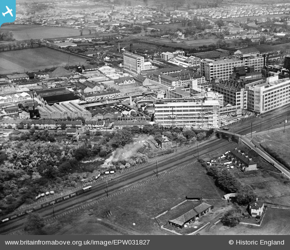
EPW031827 ENGLAND (1930). Gramophone Company (HMV) factory buildings and environs, Hayes, 1930
© Copyright OpenStreetMap contributors and licensed by the OpenStreetMap Foundation. 2026. Cartography is licensed as CC BY-SA.
Nearby Images (24)
EPW031827
 factory buildings and environs, Hayes, 1930")
EPW031826
 factory buildings and environs, Hayes, 1930")
EPW031832
 factory buildings and environs, Hayes, 1930")
EPW015335

EPW031830
 factory buildings and environs, Hayes, 1930")
EPW031824
 factory buildings and environs, Hayes, 1930")
EPW031825
 factory buildings and environs, Hayes, 1930")
EPW015332

EPW031823
 factory buildings and environs, Hayes, 1930")
EPW008028

EPW031822
 factory buildings and environs, Hayes, from the south, 1930")
EPW015336

EPW031829
 factory buildings and environs, Hayes, from the south-west, 1930")
EPW015337

EPW031839
 factory buildings and environs, Hayes, 1930")
EPW031842
 factory buildings and environs, Hayes, 1930")
EPW031828
 factory buildings and environs, Hayes, from the south-west, 1930")
EPW005150

EPW008027

EPW005151

EPW037590

EPW031833
 factory buildings and environs, Hayes, from the south-west, 1930")
EPW031831
 factory buildings and environs, Hayes, from the south-west, 1930")
EPW008026

Details
| Title | [EPW031827] Gramophone Company (HMV) factory buildings and environs, Hayes, 1930 |
| Reference | EPW031827 |
| Date | 7-May-1930 |
| Link | |
| Place name | HAYES |
| Parish | |
| District | |
| Country | ENGLAND |
| Easting / Northing | 509114, 179605 |
| Longitude / Latitude | -0.42769594573547, 51.504348830859 |
| National Grid Reference | TQ091796 |
Pins

Class31 |
Monday 7th of October 2013 04:30:27 PM |
User Comment Contributions

An eastbound freight from the bridge 09/09/2013 12.12hrs |
Class31 |
Tuesday 7th of January 2014 11:16:03 AM |