
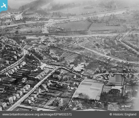
EPW031571 ENGLAND (1930). Arnison Road, Bridge Road and the area around the River Mole, East Molesey, 1930. This image has been produced from a copy-negative.
© Copyright OpenStreetMap contributors and licensed by the OpenStreetMap Foundation. 2026. Cartography is licensed as CC BY-SA.
Nearby Images (3)
EPW031571

EPW056839

EPW056834

Details
| Title | [EPW031571] Arnison Road, Bridge Road and the area around the River Mole, East Molesey, 1930. This image has been produced from a copy-negative. |
| Reference | EPW031571 |
| Date | February-1930 |
| Link | |
| Place name | EAST MOLESEY |
| Parish | |
| District | |
| Country | ENGLAND |
| Easting / Northing | 515105, 168112 |
| Longitude / Latitude | -0.34514530432261, 51.399851669935 |
| National Grid Reference | TQ151681 |
Pins

Paolo |
Tuesday 17th of May 2016 11:08:26 AM | |
|
Paolo |
Tuesday 12th of April 2016 04:50:08 PM | |
|
Paolo |
Tuesday 12th of April 2016 04:50:03 PM | |
|
Paolo |
Monday 8th of June 2015 03:11:53 PM | |
|
Paolo |
Wednesday 3rd of June 2015 11:57:08 AM | |
|
Paolo |
Wednesday 3rd of June 2015 11:54:28 AM | |
|
Paolo |
Wednesday 3rd of June 2015 11:52:05 AM | |
|
Paolo |
Wednesday 3rd of June 2015 11:51:30 AM |