
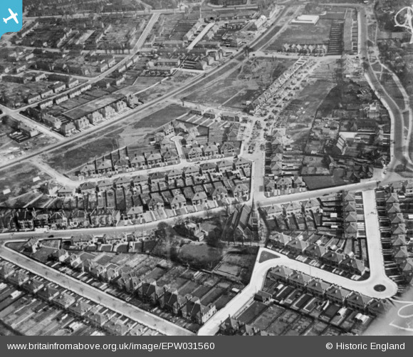
EPW031560 ENGLAND (1930). St Dunstan's Church, Friars Place Lane, Bowes Road and environs, Acton, 1930. This image has been produced from a copy-negative.
© Copyright OpenStreetMap contributors and licensed by the OpenStreetMap Foundation. 2026. Cartography is licensed as CC BY-SA.
Nearby Images (4)
EPW031560

EPW031283

EPW031284

EPW031559

Details
| Title | [EPW031560] St Dunstan's Church, Friars Place Lane, Bowes Road and environs, Acton, 1930. This image has been produced from a copy-negative. |
| Reference | EPW031560 |
| Date | February-1930 |
| Link | |
| Place name | ACTON |
| Parish | |
| District | |
| Country | ENGLAND |
| Easting / Northing | 521050, 180840 |
| Longitude / Latitude | -0.2553587966349, 51.513018479483 |
| National Grid Reference | TQ211808 |
Pins
Be the first to add a comment to this image!