
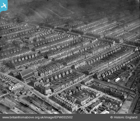
EPW031502 ENGLAND (1930). St Paul's Church and terraced housing surrounding Burgoyne Road, Umfreville Road and Cavendish Road, Harringay, 1930
© Copyright OpenStreetMap contributors and licensed by the OpenStreetMap Foundation. 2026. Cartography is licensed as CC BY-SA.
Nearby Images (2)
EPW031502

EPW031662

Details
| Title | [EPW031502] St Paul's Church and terraced housing surrounding Burgoyne Road, Umfreville Road and Cavendish Road, Harringay, 1930 |
| Reference | EPW031502 |
| Date | February-1930 |
| Link | |
| Place name | HARRINGAY |
| Parish | |
| District | |
| Country | ENGLAND |
| Easting / Northing | 531644, 188323 |
| Longitude / Latitude | -0.099958531841013, 51.577902423747 |
| National Grid Reference | TQ316883 |
Pins

Class31 |
Wednesday 13th of February 2013 03:05:20 PM | |
|
Class31 |
Wednesday 13th of February 2013 03:04:57 PM | |
|
Class31 |
Wednesday 13th of February 2013 03:04:29 PM | |
|
Class31 |
Wednesday 13th of February 2013 03:03:48 PM | |
|
Class31 |
Wednesday 13th of February 2013 03:03:16 PM | |
|
Class31 |
Wednesday 13th of February 2013 03:00:35 PM | |
|
Class31 |
Wednesday 13th of February 2013 02:54:58 PM | |
|
Class31 |
Wednesday 13th of February 2013 02:54:24 PM | |
|
Class31 |
Wednesday 13th of February 2013 02:53:40 PM | |
|
Class31 |
Wednesday 13th of February 2013 02:52:32 PM |